Level 2 Ocean Salinity User Data Product (UDP) data for 2013, are used in this project. Only ascending orbits are retained, and the Roughness Model 1 (SSS_1) is used. The full swath is retained.
Spatial resolution is ~7.5km, and temporal resolution is daily.
In order to use SMOS SSS data with DINEOF, the following steps have been performed:):
- Quality flags used (provided with the L2 files):
- Fg_ctrl_poor_geophysical
- Fg_ctrl_poor_retrieval
- Dg_quality_SSS1
- A minimum and maximum check is done pixel by pixel, using as limits the monthly background fields described in this page.
- An outlier detection approach is applied, using the technique developed in Alvera-Azcárate et al, 2012. Below is an image showing the application of outlier detection to SSS data.
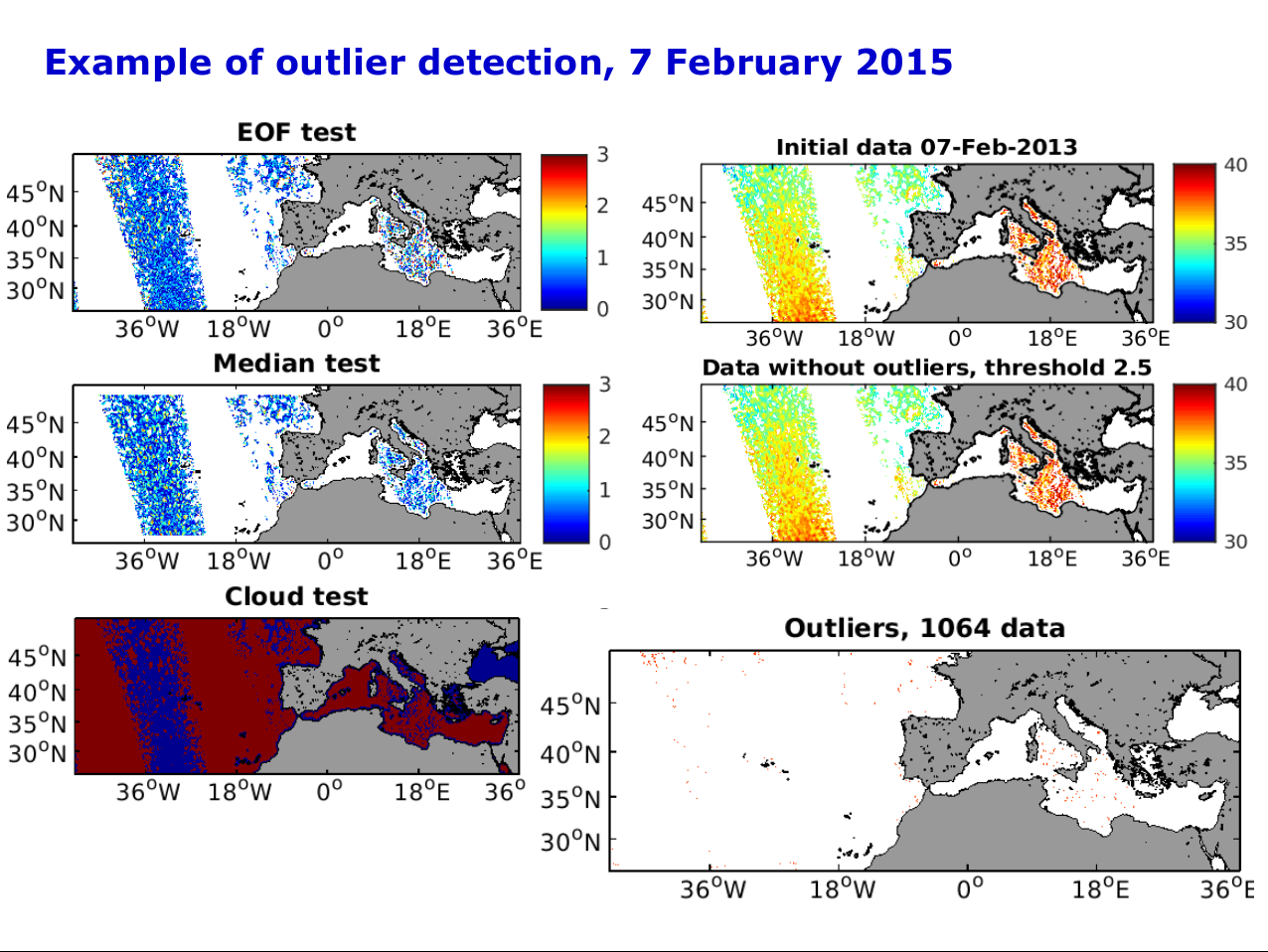
Three tests are realised:
– Departure from a DINEOF truncated EOF basis
– Departure from a local median
– Proximity to clouds, land or missing values
A weight of 1/3 is given to each of the three sub-tests, and those pixels that have a value higher than 1 are classified as outliers.